
New Chinese structures confirmed via satellite imagery
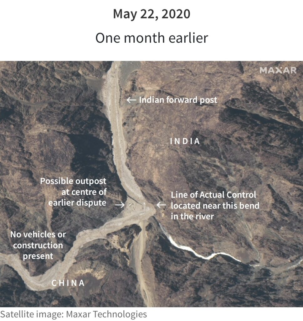
Image source: Reuters
China appears to have added new structures near the site of a deadly border clash with India in the western Himalayas. Fresh satellite pictures show Chinese structures, heightening concerns about further flare-ups between the nuclear-armed neighbours. Indian and Chinese military commanders agreed on Monday to step back from a weeks-old standoff at several locations.

Image source : Reuters
Along their disputed border following the June 15 clash in the Galwan Valley in which 20 Indian soldiers were killed. The satellite images showing new construction activity in the week following the brutal hand-to-hand combat. Underline the challenge of disengagement and the risk the accord could still fall apart because of overlapping claims in the arid territory.
The pictures shot on Monday by U.S.-based space technology firm Maxar Technologies show what appears to be extensive Chinese structures. That is on a raised river terrace overlooking the Galwan River. India says the area where the structures have sprung up are on its side of the poorly defined, demarcated Line of Actual Control. Or the de facto border between the two Asian giants.
China says the whole of Galwan valley, located at about 14,000ft (4,300m), is its territory and blames Indian troops for triggering the clashes.
Update by Soujashh Singha
For more update click here.
[…] For more daily updates click here. Also for more related news updates click here. […]